Windstorm Topples Section of CSX Intermodal Train
Written by David C. Lester, Editor-in-Chief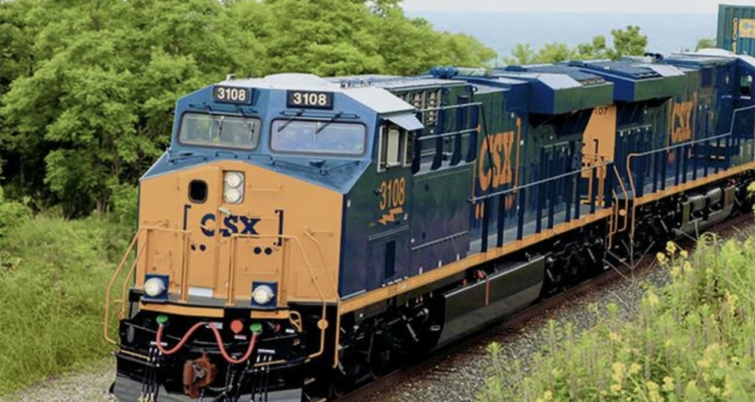
CSX
HANCOCK COUNTY, Ohio –– Part of a CSX intermodal train was blown off the tracks by a heavy windstorm associated with severe weather moving through Ohio.
CSX Incident
The Hancock County Sheriff’s Office reported the derailment occurred near the intersection of State Route 613 and Township Road in Washington Township just after 12:30 a.m. Thursday.
WTOL-TV, the CBS affiliate in Toledo, reported that the Sheriff’s Office determined that several cars of the CSX intermodal train had been turned on their sides by the wind, but the train had not been moving when the windstorm occurred. Authorities also determined that here were no hazardous materials on the train, and no leaks or injuries occurred as a result ot the derailment.
The station reported that CSX made a statement including a note that 18 intermodal cars derailed and said the incident was caused by high-speed winds.
One resident, Karin Graeff, was quoted as saying “Thankfully, I still have a roof because if it pulls [a train] off the tracks, that’s quite a bit of wind. I’m glad all of our neighbors are still intact and everyone seems OK.
CSX said in a statement that 18 total cars derailed and attributed the incident to high-speed winds.
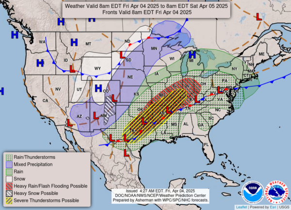
National Weather Map as of 8:00am EDT Friday, April 4 – National Weather Service
What’s Happened Elsewhere in the Midwest
According to CNN, dozens of communities in the Central US have suffered severe devastation from the line of thunderstorms moving through this week, a system which generated dozens of thunderstorms. To make matters worse, weather scientists and forecasters are calling for more violent weather to the midwest, with heavy rains and major thunderstorms that could generate what it referred to as “generational” flooding over the weekend.
Norfolk Southern Issues Weather Alert
Norfolk Southern issued a Customer Service Alert this week regarding their plans to minimize service disruptions where possible.
“Norfolk Southern is closely monitoring a powerful, slow-moving weather system expected to bring potentially historic flash flooding and severe weather to central portions of our rail network beginning as early as Wednesday, April 2, and continuing through the weekend.
“Forecasts now call for a tropical-like firehose of moisture to stall over the region, producing repeating rounds of torrential downpours across a 1,000-mile-long swath from Arkansas through Kentucky and into Ohio. Some areas could see a foot or more of rainfall, equivalent to four months’ worth of precipitation in just five days. AccuWeather warns that flooding may exceed 500- to 1,000-year averages, posing a significant risk to communities, infrastructure, and transportation.
“To prepare, Norfolk Southern is prepositioning crews, equipment, and materials in strategic locations to respond quickly to any service disruptions. Our Operations and Network Planning teams are actively coordinating across affected regions to minimize delays and maintain fluidity where safe.”
“Potential Service Impacts:
- Customers with shipments moving through the Lower Mississippi Valley, Ohio Valley, Southeast, and Mid-Atlantic should anticipate potential service delays due to flooding, high water, and storm-related impacts.
- Secondary roads and infrastructure near rail corridors may also be affected, which could impact access and local interchange operations.
In areas where flooding impacts rail operations, we will move swiftly to restore service as soon as conditions safely permit.”
Further Reading on High Wind Threat to Railroads
Please see these additional articles from RT&S on wind damage and prevention.
RT&S will continue to monitor the weather over the next few days.