Watch: Take a tour over and into Toronto’s Finch West LRT route in new drone footage
Written by David C. Lester, Editor-in-Chief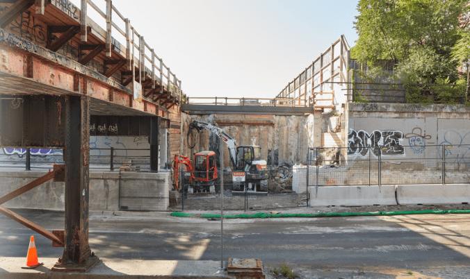
Take a tour over and into Toronto’s Finch West LRT route in new drone footage
Metrolinx
There’s a lot of sides to take in, as the Finch West light rail transit project digs in and moves along one of Toronto’s most iconic roadways. And to see the state of the work, we have new drone footage that includes getting below the frost line.
Better duck.
New video from the Finch West light rail transit (LRT) route starts out inside the cavern created for the centrepiece Finch West Station. The drone was able to move through supports and among beams as the hub is being carved out. Follow this link for the video: https://videopress.com/embed/Febh5d6Z?cover=1&preloadContent=metadata&hd=1
From there, the tour takes in every major intersection along the 11 km. line.
Finch West LRT will run along Finch Avenue West from Keele Street to Highway 27, where it will turn, then travel south to the Humber College north campus. It will connect with Toronto as well as Peel and York Regions local transit.

The video is a timely look at how far work has come, especially for locals and business owners who have been patient in contending with work on the important transit route.
Want to know more about the LRT line? Just go here.